
Martinico — Martinique
€950
- Cartographer
- Thomas Jefferys / Robert Sayer
- Date
- 1775
- Subject
- Martinique, Caribbean
- Dimensions
- 46 × 61 cm engraving / 52.5 × 72.5 cm sheet
- Condition
- Good condition.
- References
- D. Gestetner, “Thomas Jefferys’ West-India Atlas, 1775”, MapForum 7 (2005), pp. 40–48, and 8 (2005), pp. 30–35; Phillips 2699.
About this piece
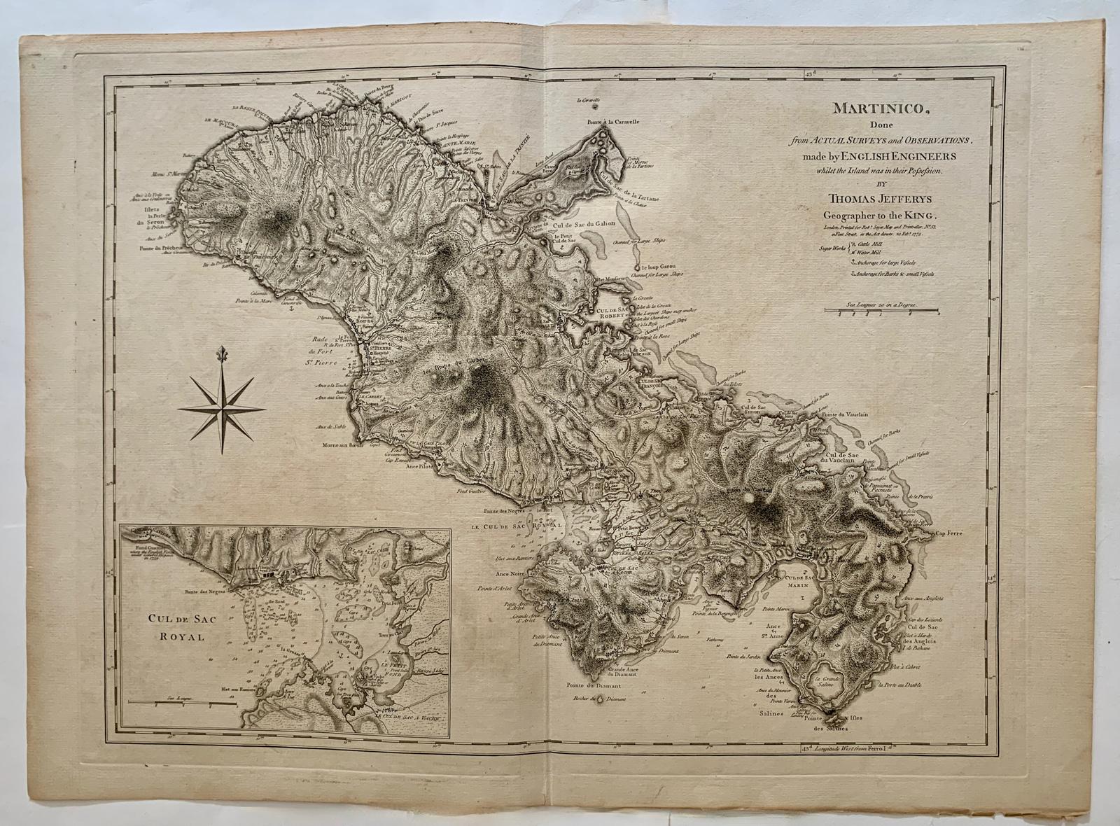
Martinico is Thomas Jefferys’s large copper-engraved map of Martinique, published by Robert Sayer in London in 1775 for The West-India Atlas. It draws on surveys made by British military engineers during Britain’s occupation of the island. Their work gave the plate a remarkable level of detail, from the outline of the coast to the roads and estates inland.
The map reads differently from the sea and from the land. Around the coast, shoals and anchorages explain how a vessel could approach the island. Inland, roads connect settlements, fortifications and sugar works. The engraver even distinguishes between mills driven by water and those worked by cattle, a small mark on the page that opens up the agricultural history of eighteenth-century Martinique. The same survey records churches and wooded areas alongside the military and commercial features.
A large inset of the Cul de Sac Royal gives the harbour its own scale. Now the Bay of Fort-de-France, it was protected by Fort Royal. The inset makes the relationship between the fort, the harbour entrance and the shelter inside the bay particularly clear.
The engraving measures 46 × 61 cm on a sheet of 52.5 × 72.5 cm. The middle fold is reinforced on the reverse, and there is light discolouration and wear along the lower edge. Recorded in Phillips, no. 2699, and D. Gestetner, MapForum 7–8 (2005).
Condition: Good condition. References: D. Gestetner, “Thomas Jefferys’ West-India Atlas, 1775”, MapForum 7 (2005), pp. 40–48, and 8 (2005), pp. 30–35; Phillips 2699.