
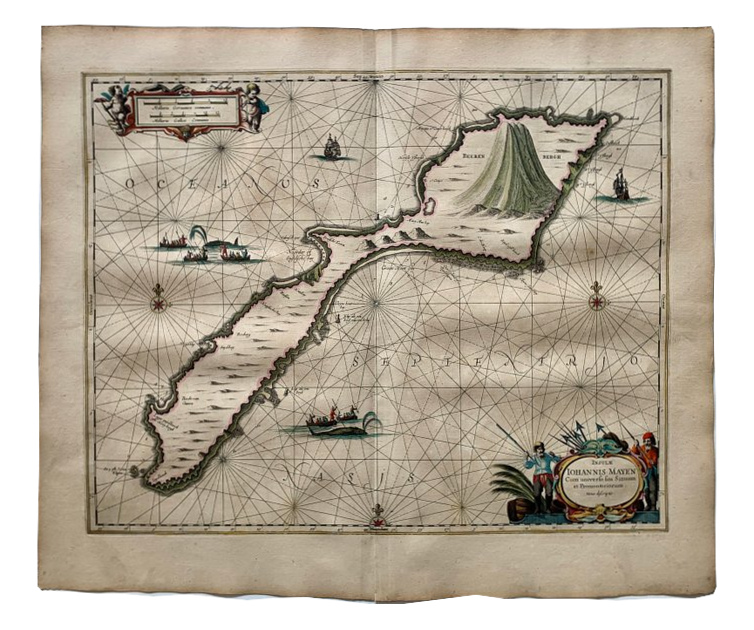
Jan Mayen Island, Norway, 1650 - Johannes Janssonius
€400
- Cartographer
- Johannes Janssonius
- Date
- 1650
- Publication
- Amsterdam, Atlantis Majoris Quinta Pars
- Original title
- Insulae Iohannis Mayen cum universo situ Sinuum et Promontoriorum
- Subject
- Jan Mayen, Norway, Arctic Ocean
- Medium
- Copper engraving with contemporary hand colouring
- Engraving dimensions (cm)
- 40.5 × 51.3
- Paper dimensions (cm)
- 50 × 59.7
- Condition
- Good, with an old repair to a tear at the lower middle fold
About this piece
An early nautical chart of Jan Mayen by Johannes Janssonius, published in Amsterdam in 1650 in Atlantis Majoris Quinta Pars, the maritime volume of his Atlas Novus. The copper engraving retains its contemporary hand colouring. It shows the remote volcanic island through the features that would have mattered most to readers at sea, including bays, headlands and approaches.
Compass roses and rhumb lines surround the island, and Beerenberg rises above the northeastern end. Small scenes of sailing ships and men pursuing whales recall the island’s place in the seventeenth-century Dutch whaling trade. The figures flanking the title cartouche hold whaling equipment, and the scale sits in an ornate cartouche in the opposite corner. These small details give the chart the character of a working maritime image as well as an atlas engraving.
The title identifies both the island and its bays and headlands. At this scale a reader can compare the indented coast with the open water around it, then pick out the ships and whaling figures that give the sheet its human scale. The varied line work holds together the shore, the sea and the working lives associated with it.
The engraving measures 40.5 × 51.3 cm on a 50 × 59.7 cm sheet. The condition is good, with an old repair to a tear at the lower middle fold.