
Views of Surat & Batavia
€125
- Cartographer
- Henri Chatelain
- Date
- 1720
- Publication
- Amsterdam
- Original title
- Vue et Description de Surate et de Batavia.
- Subject
- Surat, India; Batavia, Indonesia
- Medium
- Copper engraving with later hand colouring
- Engraving dimensions (cm)
- 37 × 21.5
- Paper dimensions (cm)
- 45.5 × 28.3
- Condition
- Good
- Availability
- Subject to availability · Please enquire
About this piece
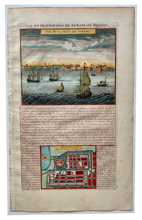
An original copper engraving with later hand colouring by Henri Chatelain, published in Amsterdam in 1720. It brings together Surat, on India’s western coast, and Batavia, the city now known as Jakarta. The print sets two important ports on the same sheet, using a waterfront view for one and an urban plan for the other.
At Surat, sailing vessels in the foreground lead the eye to the long line of buildings along the shore. The view gives a sense of approaching the city by water. Below, the compact plan of Batavia is picked out in red, green and blue. It invites a closer look at how the streets and built-up areas were set out. French text surrounds the images and supplies their original explanatory setting.
The two illustrations answer different questions about a port. The Surat view puts ships in the foreground and shows how a visitor would have seen the city on arrival. Batavia’s plan explains how the settlement was laid out. The pairing makes the sheet a compact example of the way the Atlas Historique brought views, plans and written geography together.
The engraving measures 37 × 21.5 cm on a 45.5 × 28.3 cm sheet. The paper is in good condition.