
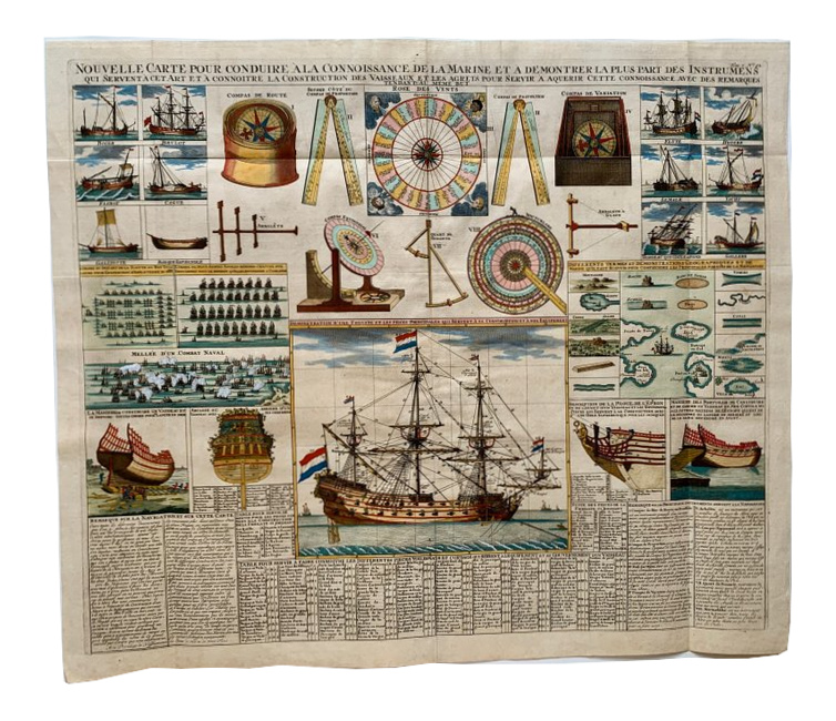
Navigation & Shipbuilding, c. 1720 - Henri Chatelain
€650
- Cartographer
- Henri Chatelain
- Date
- c. 1720
- Publication
- Amsterdam, Atlas Historique
- Original title
- Nouvelle Carte pour conduire à la connoissance de la Marine…
- Subject
- Navigation, naval instruments and shipbuilding
- Medium
- Copper engraving with later hand colouring
- Engraving dimensions (cm)
- 49.5 × 58
- Paper dimensions (cm)
- 53.5 × 63
- Condition
- Very good, folds as issued
About this piece
A large copper engraving with later hand colouring from Henri Chatelain’s Atlas Historique, published in Amsterdam around 1720. A fully rigged frigate under Dutch flags fills the centre. Around it, the smaller illustrations move from finished vessels to the parts and instruments on which their construction and navigation depended.
The sheet can be read from the outside in. A compass and wind rose introduce the practical problem of direction, while smaller views of rigging and the sections of a ship under construction show what sits behind the finished silhouette. French text and tables name parts of the ship and explain how instruments were used. The large central frigate gives those diagrams a form the reader can return to.
The dense French captions are part of the design. They move between the language of the shipyard and that of the navigator, so the same page explains how a vessel was built, how its rig was arranged and how its course was plotted. The hand colouring makes it easier to follow the separate diagrams back to the frigate at the centre.
The engraving measures 49.5 × 58 cm on a 53.5 × 63 cm sheet. Very good condition, with folds as issued. A strip is visible along the middle fold on the reverse.