
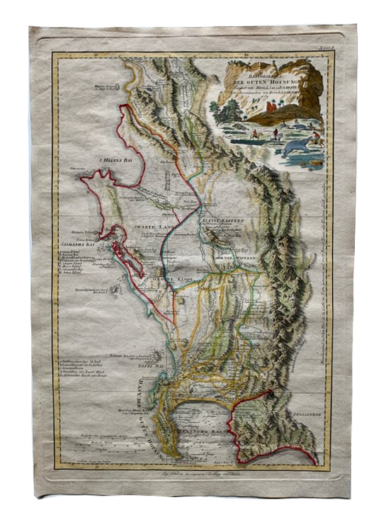
Cape of Good Hope, South Africa, 1789 - de la Rochette
€150
- Cartographer
- Louis Stanislas de la Rochette
- Date
- 1789
- Publication
- Vienna, Franz Anton Schraembl
- Original title
- Das Vorgebirg der Guten Hofnung
- Subject
- Cape of Good Hope, South Africa
- Medium
- Hand-coloured engraving
- Engraving dimensions (cm)
- 49 × 32.5
- Paper dimensions (cm)
- 55 × 37.5
- Condition
- Very good
About this piece
A hand-coloured engraving of the Cape of Good Hope and the surrounding Cape Colony, published by Franz Anton Schraembl in Vienna in 1789. This German-language version follows Louis Stanislas de la Rochette’s map, published by William Faden in London in 1782. The two imprints show how a regional map could be reissued for readers in a different language and market.
The coastline runs from St Helena Bay to the Cape Peninsula and False Bay. Cape Town and Table Bay sit where the inland and maritime parts of the map meet. Densely engraved mountain ranges give the interior its texture, while coloured lines make routes and boundaries easier to distinguish. A pictorial cartouche sets the title against a rocky coastal landscape, echoing the subject of the engraving.
Table Bay offers a useful point from which to read the sheet. The finely worked mountains gather behind the settlement, and the coast continues in quite different directions around the peninsula. The German title places this familiar maritime landmark within the wider regional geography offered to readers of Schraembl’s atlas.
The printed image measures 49 × 32.5 cm on a 55 × 37.5 cm sheet. The paper is in very good condition.